Monday, January 24, 2011

WORLD COASTS ALL OVER THE WORLD

Europe
1. Norway
2. Svalbard and Jan Mayen
3. Sweden
4. Finland
5. Russian East Baltic
6. Estonia
7. Latvia
8. Lithuania
9. Kaliningrad
10. Poland
11. Germany
12. Denmark
13. The Netherlands
14. Belgium
15. North Coast of France
16. West Coast of France
17. Mediterranean France
18. Corsica
19. Spain
20. Gibraltar
21. Portugal
22. Italy
23. Malta
24. Slovenia, Croatia, Bosnia and Yugoslavia
25. Albania
26. Greece
27. Bulgaria
28. Romania
29. Ukraine
30. Sea of Azov

Russian Federation
1. Russian Baltic (The Russian Gulf of Finland and Kaliningrad)
2. Russian Black Sea Coast
3. The Pacific Coast of Russia
4. The Arctic Coast of Russia
5. The Arctic Coast of Russia: Appendix A
6. Russian Caspian Coast

Middle East
1. Republic of Georgia
2. Turkey
3. Cyprus
4. Syria
5. Lebanon
6. Israel (with the Gaza Strip)
7. Jordan

Caspian Sea
1. Iran - Caspian Sea Coast
2. Turkmenistan
3. Kazakhstan
4. Caspian Russian Coast
5. Azerbaijan

North Africa
1. Egypt
2. Libya
3. Tunisia
4. Algeria
5. Morocco

West Africa
1. Mauritania
2. Senegal and Gambia
3. Guinea Bissau
4. Republic of Guinea
5. Sierra Leone
6. Liberia
7. Ivory Coast
8. Ghana
9. Togo and Benin
10. Nigeria
11. Cameroon and Equatorial Guinea
12. Gabon, Congo, Cabinda and Zaïre
13. Angola
14. Namibia

South Africa
1. South Africa

East Africa
1. Mozambique
2. Tanzania
3. Kenya
4. Somalia and Djibouti
5. Eritrea
6. Sudan

South West Asia
1. Saudi Arabia
2. Yemen and Oman (Southern Arabia)
3. United Arab Emirates
4. Qatar
5. Bahrein
6. Kuwait and Iraq
7. Iran

South Asia
1. Pakistan
2. India
3. Sri Lanka
4. Bangladesh
5. Burma

Indian Ocean
1. Madagascar
2. Indian Ocean Islands

South East Asia
1. Thailand
2. Malaysia Introduction
3. Malaysia - Perlis
4. Malaysia - Kedah and Langkawi
5. Malaysia - Penang
6. Malaysia - Perak
7. Malaysia - Selangor
8. Malaysia - Negeri Sembilan
9. Malaysia - Melaka
10. Malaysia - Johor
11. Malaysia - Pahang
12. Malaysia - Terengganu
13. Malaysia - Kelantan
14. Malaysia - Sabah and Labuan
15. Malaysia - Sarawak
16. Singapore
17. Brunei (Negara Brunei Darussalam)
18. Cambodia
19. Vietnam
20. Philippines
21. Indonesia
22. East Timor
23. Papua New Guinea

East Asia
1. China
2. Taiwan
3. North Korea
4. South Korea
5. Japan

Australia
1. Australia Introduction
2. New South Wales (with Jervis Bay - Australian Capital Territory)
3. Lord Howe Island - (New South Wales)
4. Norfolk Island
5. Queensland
6. Northern Territory
7. Western Australia
8. South Australia
9. Victoria
10. Tasmania

New Zealand
1. New Zealand

Pacific Ocean
1. New Caledonia and the Loyalty Islands
2. Fiji
3. Society Islands
4. Other Pacific Islands

Antarctica
1. Antarctica
Canada
1. British Columbia
2. Eastern Canada
3. Saint-Pierre-et-Miquelon Islands
4. Northern Canada


Caribbean Islands
1. Cuba
2. Jamaica
3. Hispaniola (Haiti and the Dominican Republic)
4. Puerto Rico
5. Lesser Antilles

Atlantic Ocean
1. Bahamas
2. Bermuda
3. Greenland
4. Iceland
5. Other Atlantic Ocean Islands

British Isles
1. Introduction to England and Wales
2. Cumbria
3. Lancashire, Merseyside and Cheshire
4. Isle of Man
5. North Wales and Anglesey
6. West Wales
7. South Wales
8. Severn Estuary
9. Avon, Somerset and North Devon
10. Cornwall
11. Isles of Scilly
12. South Devon
13. Dorset
14. Hampshire
15. Isle of Wight
16. Sussex
17. Kent
18. Essex
19. Suffolk
20. Norfolk
21. Lincolnshire
22. Yorkshire and Cleveland
23. Durham, Tyne and Wear
24. Northumberland
25. Scotland
26. Northern Ireland
27. Ireland

28. Channel Islands

Wednesday, January 19, 2011

United States of America south america,central america coasts

United States of America
1. Alaska
2. Washington
3. Oregon
4. California
5. Texas
6. Louisiana
7. Mississippi
8. Alabama
9. Florida
10. Georgia and South Carolina
11. North Carolina
12. Atlantic Coast Central :- (Virginia, Maryland, Delaware and New Jersey)
13. New York and New England
14. Great Lakes
15. Hawaii
Central America
1. Mexico
2. Pacific Coasts of Guatemala, El Salvador, Honduras, Nicaragua, Costa Rica and Panama
3. Caribbean Coasts of Panama, Costa Rica, Nicaragua, Honduras, Guatemala and Belize
4. Colombia

South America
1. Ecuador
2. Peru
3. Chile
4. Argentina
5. Uruguay
6. Brazil
7. French Guiana
8. Surinam
9. Guyana
10. Venezuela

Friday, January 14, 2011

PAKISTAN INTERNATIONAL CONTAINER TERMINAL

Karachi also plays the major roll for the economy of Pakistan being the coastline and only harbor for the country. Kemari, Karachi Port Trust (KPT) is a Pakistan’s oldest Sea port It is also significant to mention that the first Muslim Conqueror to India, Mohammad Bin Qasim, landed at Daibal, in vicinity of Karachi in 711 A.D. the existing Port started taking shape in 1854, when the projects of dredging the main navigable channel and the construction of a mole or causeway joining the main harbor with the rest of the city were undertaken. About 5 years later, construction of Manora Breakwater, Keamari Groyne, the Napier Mole Bridge, Native Jetty and the Chinna Creek were started which gave initial shape to the port.
The construction of the wharves started in 1882, and by 1914 the East Wharves and the Napier Mole Boat Wharf had been completed. During the period between 1927 and 1944, the West Wharves of the Port, the lighterage berths and the ship-repairing berths were constructed. Most of these facilities were obsolete by the time Pakistan came into existence in 1947. Since then, the port administration has embarked on extensive development of the port on modern lines. At the time of independence in 1947, the Port capacity was about 1.5 million tons of dry cargo and 1.0 million tons of P.O.L. products per annum. Karachi Port is now handling over 14 million tons of liquid cargo and 12 million tons of dry cargo, including 652,315 TEUs which constitute about 80% of import/ export of the country
Total Area of berths 6-9 is 220,000 square meters. Berths newly constructed by KPT with a planned depth of 13.5m and quay wall of 600 meters. Pakistan International Container Terminal was formed as the Terminal Operating Company and dedicated container terminal operations commenced on August 9th , 2002. PICT has taken possession of approximately 208,000 square meters of area and completed necessary civil works and office construction for the smooth functioning of the Terminal. The Terminal now possesses dedicated Custom Facilities, Customer Services with one window facilities – including collection of KPT Wharfage dues, Operations Office, Communications Centre and round the clock Private Terminal Security. PICT is providing services to 4 liner shipping lines weekly (on average) and handling container volumes of over 240,000 TEU’s annually.

PICT has 200 Reefer Points Operational and are expanding the capacity further.
PICT has acquired the following new equipment for the timely completion of Phase 1 which was achieved in March 2004:
 

2 Ship-to-Shore Gantry Cranes
4 Rubber Tyred Gantries
          
4 Reach Stackers, 1 Top Lifter
 
2 Empty Container Handlers
      
2 Container Stuffing Forklifts
    
10 Tractor Units
 

20 Trailer Units 
                            
5 Service Vehicles

Karachi The Busy Port City of Pakistan

Karachi in southern Pakistan, is the capital of the Sind Province, and lies on the Arabian Sea, at the northwestern edge of the Indus River delta. With its wide sunny beaches, deep-sea fishing, and horse racing all-year round, the city keeps you on your toes throughout your stay.
Karachi is also a major port centered on the island of Kiamari, and along with its international airport they act as a hub for international trade, transport, manufacturing and commerce. Karachi is the country’s center of commerce although the capital was moved to Islamabad in 1963.
The Karachi Harbor was once known as the gateway to Asia, due to its strategic geographical location. The harbor is a sheltered bay to the south-west of the city, protected from storms by the Sandspit Beach, the Manora Island and the Oyster Rocks, making it even more ideal. Karachi was a small fishing village in the early 19th Century but its history dates back much further and some historians identify it as a place from where a part of Alexander's Army boarded the Greek Flotilla in 326 BC.
Two rivers pass through the city—the River Malir and the River Lyari. Dense mangroves and creeks of the Indus delta can be found towards the southeastern side of the city.

Under British rule, the city became the chief outlet for Indus Valley cotton and grain exports. Spread over 3,530 sq. km, the metropolitan area along with its suburbs comprises the world's second most populated city. The region is largely flat or in some places has rolling plains, with hills on the western and northern boundaries of the urban sprawl. It is locally called the City of Lights for its liveliness and the City of The Quaid, for not only being both the birth and death place of Muhammad Ali Jinnah the founder of Pakistan but also his home after 1947.

Coastal Attraction

Most of us are fascinated by the sea. We belong on dry land but a marine panorama holds an awe-inspiring response matched only by the night sky, mountain ranges and great forests. From childhood to old age, being on the edge of the land holds a fascination. Everything about the coast is unique, the light is brighter and bluer, the air is fresher, the flora and fauna are specialised and the weather is often localised. These are just some of the things make the coast a special place to be, whether for a holiday break or for the long term.
We hope you enjoy looking at, and probably dreaming about, what it must be like to live in or spend quality time in these lovely places. More than that, we hope you actually find yourself breathing in the sea air, eating fresh fish and feeling the sand between your toes.

Clouds started pouring their blessed water in Karachi

 It was such a lovely weather that I couldn’t stop myself from enjoying it and celebrating the beautiful weather with my friends. What could be a better place to visit other than SEA VIEW, the best of the best place in Karachi.
Let me give you an over view of Sea View, it’s actually corniche of Karachi. The moment you reach sea view road, you see beautiful heart throbbing waves splashing and hitting the edge. Lots of people go there to see the sunset, and many even go there to see the sunrise, people jog/walk there and many rich lads bring their horse for horse-riding on seaside (who would miss if one gets an opportunity).
Many bhutta Wala’s, goley gandey wala, Kehwa, Chaye wala are roaming there to serve you. But now there are many take away outlets there that have all the cuisines from Pizzas, burgers, sandwiches, rolls, biryani, juices, coffee, tea etc.
Not to forget Pizza Hut van there, a drive-thru McDonalds, Salt n pepper Village, Floating Boat, etc (hope I didn’t miss any)After sunset, normally people think that it might get dark there and dangerous but let me tell you it’s so bright there, that you might find a dropped common pin because there are so many lamp posts with brighter lights in them and many cops roaming around for security.

It’s a safe and calm place where waves that might seem quiet have so much noise in them that many a times people get afraid of these waves, especially when oil spills in the sea or when there is cyclone news, sea view road gets closed for security purposes. Not to forget, one can’t date there because of our efficient Karachi police. So there is no chance for youngsters to do anything

Tuesday, January 11, 2011

Introduction port qasim

Port Muhammad Bin Qasim is adjacent to the town of the same name in southeastern Karachi, Pakistan, on the Arabian Sea and the delta of the Indus River. Port Muhammad Bin Qasim was constructed in the 1970s to take some of the burgeoning traffic clogging the Port of Karachi. Today, it is Pakistan’s’ second biggest port.Vessels approach Port Muhammad Bin Qasim through a 45-kilometer Navigation Channel that can accommodate vessels to 75 thousand DWT. Tidal variation at Port Muhammad Bin Qasim ranges from 0.5 to 3.5 meters. One of Port Muhammad Bin Qasim’s advantages its location near the national highway network (the National Highway is 15 kilometers away), the rail network (the National Railway is 14 kilometers away), and air transport (22 kilometers from Jinnah International Airport). The National Railway has six tracks immediately behind the berths.
Port Muhammad Bin Qasim contains nine berths that handle cargo. It contains a multi-purpose terminal with four multi-purpose berths, each 200 meters in length. The Qasim International Container Terminal has two berths, each 300 meters long. The Engro Vopak Chemical Terminal has one berth. Pakistan Steel Mills uses the 279-meter-long Iron Ore and Coal Berth. The Fotco Oil Terminal has one berth but has room to add another four.
Port Muhammad Bin Qasim’s International Container Terminal contains two container-handling berths that were converted from four former multi-purpose berths. The terminal is the country’s first dedicated international container terminal, and it has been operating since mid-1997. The terminal covers 240 thousand square meters and has capacity to handle 360 thousand TEUs per year. It can accommodate vessels to 272 meters long and up to 45 thousand DWT. The terminal has rail-mounted ship-to-shore gantry cranes.
Working with Pakistan GasPort, Port Muhammad Bin Qasim is adding a floating Liquefied Natural Gas Terminal that will handle 3 million tons per year and accommodate vessels to 75 thousand DWT. Initial detailed surveys have been completed, and the project is scheduled to be completed in late 2010. The M/s Granada Group of Companies is planning a new specialized Liquefied Natural Gas Floating Terminal that will handle 3.5 million tons per year. Technical proposals are being evaluated.
Port Muhammad Bin Qasim is adding a dedicated Coal, Clinker/Cement Terminal that will handle 4 million tons per year and accommodate vessels to 75 thousand DWT.
Port Muhammad Bin Qasim is also planning to add a second Oil Jetty to handle products from the proposed Indus Oil Refinery. The jetty will have capacity for 9 million tons per year and will accommodate vessels to 75 thousand DWT.
Pakistan Steel Mills has requested a second Iron Ore and Coal Berth at Port Muhammad Bin Qasim. The port is planning to add a facility, to be synchronized with expansions of the steel mills, with capacity for 8 million tons per year that can accommodate vessels to 75 thousand DWT. Port Muhammad Bin Qasim is completing construction of a new Liquid Cargo Terminal to handle up to 4 million tons per year. Covering an area of more than 16.5 thousand square meters, the terminal will accommodate vessels to 35 thousand DWT.
Scheduled for completion in 2010, Port Muhammad Bin Qasim is adding a second container terminal with capacity for almost 1.2 million TEUs under an agreement with Dubai Port World. Covering an area of 250 thousand square meters, the terminal will support 6000-TEU container vessels.
In addition to these projects, Port Muhammad Bin Qasim is undertaking improvements at the port that include deepening and widening the navigation channel and completing the computerization systems supporting port operations.
Port Muhammad Bin Qasim’s Fotco Oil Terminal has operated since 1995. This state-of-the-art, environmentally-friendly terminal can handle 9 million tons of furnace oil per year, and there is room to add three more berths that would raise its capacity to 27 million tons per year. The facility’s jetty can accommodate vessels to 75 thousand DWT, and the terminal can berth tankers to 63 thousand DWT. Since it opened, the terminal has handled more than 29 million tons of furnace oil. In early 2001, it started handling white oil, and it has handled British Petroleum crude oil. Anticipating growth in Pakistan’s future needs for petroleum, the terminal can have four more berths and product pipelines. In addition, Port Muhammad Bin Qasim has set aside over 31 hectares of land for a POL Storage Tank Farm.

Activity at Port Qasim

KARACHI: Brisk shipping activity was observed at 0the Port Qasim where five ships carrying containers, rice and furnace oil were berthed at Qasim International Containers Terminal, Multi Purpose Terminal and FOTCO Terminal respectively Tuesday.
Meanwhile four more ships carrying containers, general cargo and furnace oil also arrived at outer anchorage of Port Qasim on same day.
Berth occupancy was 90 percent at the Port where a total of eleven ships were engaged at PQA berths to load/offload containers, rice, sugar, seeds, canola seeds, furnace oil and palm oil respectively during last 24 hours.
A cargo volume of 10,1680 tonnes comprising 81,535 tonnes imports and 20,145 tonnes exports inclusive of containerized cargo carried in 2,148 containers (TEUs) was handled at the Port during last 24 hours.
Three containers ships sailed out to sea on early morning, while two more ships are expected to sail later today till 12 noon.
Two containers ships and one general cargo ship are expected to take berths at Qasim International Containers Terminal and Multi Purpose Terminal on Wednesday. Shipping activity remained active at the Port Qasim where two ships carrying edible oil and chemicals were berthed at Liquid Cargo Terminal and Engro Vopak Terminal respectively Monday. Meanwhile five more ships carrying containers and furnace oil also arrived at outer anchorage of Port Qasim on same day. Berth occupancy was maintained at the Port at 70 percent on Monday where a total of eight ships were engaged at PQA berths to load/offload rice, sugar, seeds, chemicals and palm oil respectively during last 24 hours.

PAKISTAN INTERNATIONAL CONTAINER TERMINAL

Total Area of berths 6-9 is 220,000 square meters. Berths newly constructed by KPT with a planned depth of 13.5m and quay wall of 600 meters. Pakistan International Container Terminal was formed as the Terminal Operating Company and dedicated container terminal operations commenced on August 9th , 2002. PICT has taken possession of approximately 208,000 square meters of area and completed necessary civil works and office construction for the smooth functioning of the Terminal. The Terminal now possesses dedicated Custom Facilities, Customer Services with one window facilities – including collection of KPT Wharfage dues, Operations Office, Communications Centre and round the clock Private Terminal Security. PICT is providing services to 4 liner shipping lines weekly (on average) and handling container volumes of over 240,000 TEU’s annually.

Monday, January 10, 2011

Death fish

The dead fish started appearing on Saturday afternoon but by Sunday evening, the number of fish has increased alarmingly,” said Keamari Town UC-4 Councilor Abdul Ghani. He added that it was not just dead fish but dead turtles that were being spotted in this area as well.
The mysterious arrival of thousands of dead fish of different sizes into the backwaters of the Karachi harbor, near Baba Island and Bhitt Island, late Saturday night, has created panic among fishermen but the Karachi Port Trust authorities have said they died in the annual Red Tide phenomenon.
Resident of Shamspir village, Suliman, blamed the harbor authorities for allowing deep sea trailers to take all the fish in the open sea, leaving the local fishermen with no choice but to fish on the polluted shores. “We don’t know what to do and how to earn our livelihood in such conditions. Many of us are thinking of changing our profession,” he said.
However, KPT officials rejected the fishermen’s claims that the fish died of toxic chemicals. “This is the work of the Red Tide, locally known as ‘Mara Pani (The killer water).’ It is a normal phenomenon and happens several times a year. There is no need to panic,” said the Karachi Port Trust (KPT) Marine Pollution Control Manager, Muhammad Zahiya Usmani. He also rejected that the fish died in the harbor limits.
“The fish died because of the high tide, outside of the harbor, and then came within the harbor limits with the tide,” said Usmani. Rejecting claims of industrial poisoning, he said that heavy layer of poisonous red algae that forms during a specific period every year, comes to the surface and attracts the fish. When the fish come in contact with the red algae and try to eat it, they die. This happens a lot but this time the high tide has brought the dead fish to the surface,” he said

Saturday, January 8, 2011

Ancient coins thata 95 km east of karachi port

Thatta is about 95 kilometers east of the Port of Karachi. This historic town of some 22 thousand residents was the capital of three dynasties before it was ruled by Delhi's Mughal emperors. The remains of the ancient glorious city illustrate the civilization of ancient Sindh. Located near Pakistan's biggest freshwater lake, its monuments are part of the UNESCO World Heritage Site. The Chaukani are tombs from the 15th to 18th Centuries that are scattered across a large area at Thatta. Each tomb is different, and their sandstone carvings illustrate the relationships between the local tribes and their neighbors in Iran, central Asia, and Turkey. Banbhore, excavated in 1962, is the place where Alexander the Great established a town in 325 BC and where the first Muslim conqueror arrived in 711 AD. The Jamia Masjid was built by Moghal Emperor Shah Jehan, the creator of the Taj Mahal. Dating from the 15th to 17th Centuries, the Makli Tombs represent a huge 15.5 square kilometer necropolis with exquisite architecture, stone carvings, and glazed tiles.
The National Museum of Pakistan, located in the Port of Karachi, focuses on the cultural history of the country. Its displays include archaeological artifacts, Islamic art, and historical documents. The museum has 11 galleries, including 52 rare manuscripts of the Holy Qur'an in the Qur'an Gallery. Other galleries cover the mysterious and ancient Indus Civilization, sculptures from the Gandhara civilization, ancient coins, precious Islamic art, miniature paintings, and many manuscripts telling the story of Pakistan's political beginnings. The Ethnological gallery contains life-size statues of the ethnic groups living today in Pakistan's four provinces. Visitors should set aside several hours to explore this wonderful museum.

Cruising and Travel karachi port

The City of Karachi is to Pakistan what New York City is to the United States. Life is hurried, and time is money. Among the world's largest cities, the Port of Karachi has suffered many years of neglect. The city government, under the direction of Pakistan's president, has recently undertaken ambitious efforts to revitalize the city with the vision of making it the "City by the Sea." With a history as an important port city in the British Empire, the Port of Karachi has many beautiful Victorian buildings and much colonial architecture.
The Port of Karachi has an arid climate moderated by its proximity to the sea. The climate is a mild one with little rain. Winters are mild, and summers are hot. The city enjoys a relatively constant level of humidity, and cool breezes from the sea relieve the summer's heat. The winter months from November to February, are thought to be the best times to visit the Port of Karachi. Temperatures range from an average high of 34 °C (93 °F) in May and June to an average low of 13 °C (55 °F) in December and January.
The Mohatta Palace Museum is located in the house of successful entrepreneur Shiv Rattan Mohatta in the late 1920s. Having made a fortune in shipping and trading, he commissioned architect Agha Hussain Ahmed who had been the chief surveyor for the city. The mansion was built in the Mughal revival style, recreating the Anglo-Mughal palaces of the earlier Rajput princes. Covering over 1.7 thousand square meters, the palace contains stately rooms for entertainment on the ground floor and private rooms above. The balcony faces the Arabian Sea, and the palace is adorned with five rooftop domes and octagonal towers at the corners. The museum features the history and development of Pakistan's ceramic crafts from the 7000 BC Mehrgarh period through the 3500 BC Indus Valley Civilization to modern times. It contains more than wonderful 400 historic objects.

commerce of karachi port

The Karachi Port Trust is the port authority for the Port of Karachi. It is administered by a Board of Trustees representing the public and private sectors. The Chairman of the Board, who is also the Chief Executive Officer for the Trust, is appointed by the Federal Government. The Karachi Port Trust is a federal government agency responsible for overseeing the Port of Karachi operations. The Trust was established by law in 1886.
The Port of Karachi boasts a natural deep-water harbor with an 11-kilometer approach channel that can accommodate up to 75 thousand DWT vessels. Two wharves are the main areas of activity for the port. The East Wharf has 17 berths, and the West Wharf has 13 berths. The maximum alongside depth of the berths is 11.3 meters.
Each Port of Karachi wharf has a container terminal. A nearby competitor, the privately-operated Al-Hamd International Container Terminal opened in 2001. The terminal is located next to the Sindh Industrial Trading Estate.
At West Wharf Berths 28-30, the Port of Karachi International Container Terminal (KICT) opened in 1996. It has capacity to handle 300 thousand TEUs of containerized cargo per year and can accommodate container vessels with maximum draft of 11 meters. The quay is 600 meters long and has two berths. The KICT was the Port of Karachi's first container terminal, and it is Pakistan's leading container terminal operator. A subsidiary of the Hutchison Port Holdings Group, the KICT meets high service standards and carefully follows best practices that improve services to Port of Karachi customers.
The Port of Karachi's Pakistan Container Terminal (PICT) is located at East Wharf Berths 6-9, and it can handle 350 thousand TEUs per year. The 600 meter long quay can accommodate two container ships with maximum draft of 11.5 meters.
The Port of Karachi also contains oil piers for handing liquid cargoes, two jetties for repairing ships, a shipyard, and an engineering facility. The shipyard site covers 29 hectares at the West Wharf and is engaged in building and repairing both military and commercial vessels. Its facilities include a large hall and three berths for shipbuilding, two dry docks, and three foundries.
The Port of Karachi Fishing Harbour is next to the West Wharf, and it is administered separately from the port. A fleet of several thousand fishing vessels operates from the fishing harbor. The fishing harbor has recently been upgraded, and a second fishing harbor was constructed at Korangi about 18 kilometers to the east.
The modern Port of Karachi is experiencing severe congestion in the flow of cargo to and from the port. Attempting to alleviate the congestion, the Pakistan government constructed a second port in the city about 30 kilometers to the east at Port Qasim and a third port about 650 kilometers west at Gwadar. Some naval vessels have been transferred to the new base at Ormara near Gwadar, further reducing congestion.
The Port of Karachi is undertaking several projects to improve the port and enhance its facilities. The approach channel to the Port of Karachi is being dredged to accommodate vessels with 12 meters draft at all tides. At the outer tip of the harbor at Kiamari Groyne, dredging to 16.5 meters will allow 300 meter long vessels to dock.
Other projects underway by the Port of Karachi include improvements to the two container terminals. The KICT will have two new berths with alongside depth of 14 meters and an additional stacking area of 100 thousand square meters, increasing handling capacity from 300 to 400 TEUs per year.
A new bulk cargo terminal will be added at the Port of Karachi's East Wharf, and the oldest oil pier will be reconstructed to accommodate 90 thousand DWT vessels. A new 40-hectare cargo village will be added for containers and general and bulk cargoes. The Port of Karachi's 100-year old NMB Wharf will be reconstructed to accommodate passenger vessels. Furthermore, a new 200-hectare Port Town will be constructed at Hawkes Bay with 13 thousand homes for port workers. The Port of Karachi will also purchase a new dredger, two harbor tugs, two hopper barges, two water barges, two pilot boats, an anchor hoist vessel, and a dredger tender.
Other Port of Karachi improvements will include a new desalination plant to help alleviate the city's water shortage. A new 150-meter tall Port Tower will be added to provide commercial and recreational space, including a revolving restaurant. A new Port Club will be added at Chinna Creek next to the Port of Karachi's East Wharf.
In late 2007, the Karachi Port Trust entered into an agreement with Hutchison Port Holdings to build a new "Pakistan Deep Water Container Port" to open in 2010. The new port will have ten berths that can accommodate super-post-Panamax container vessels.

karachi port history

The ancient Greeks had many names for the Port of Karachi. Krokola was a camp for Alexander the Great as he departed for Babylonia after his battles in the Indus valley. Alexander's admiral Nearchus set sail from Morontobara. Barbarikon was a port in the Indo-Greek Bactrian kingdom. The Arabs called the Port of Karachi Debal. In 712 AD, it was the starting point for Muhammad Bin Qasim's army.
Baloch tribes established a small fishing village near the site of today's Port of Karachi, and their descendants still live on the island of Abdullah Goth near the Port of Karachi. In the 1550s, Ottoman Admiral Sidi Ali Reis visited the city. Karachi was first mentioned as a port in an Arabic essay, Muhit, about navigation on India's west coast and in the Persian Gulf. The paper advises sailors to seek shelter in Karachi Harbor if they were in trouble.
Legend reported the existence of a flourishing coastal town, Kharak, in the late 17th and early 18th Centuries. Heavy rains silted up the harbor in 1728, and the merchants of Kharak moved to the area of the modern Port of Karachi. The old fishing village grew steadily and, by the late 18th Century, it was soon trading with Muscat across the Arabian Sea and with ports in the Persian Gulf. To protect the village and Port of Karachi, the merchants built a fortified town they called Kolachi and armed it with cannons from Muscat. The new town was surrounded by a 5-meter high mud and timber wall with two gates and gun-mounted turrets.
The Port of Karachi changed hands many times from 1729 to 1783, as the Khans of Kalat and the rulers of Sindh struggled for dominance. In 1783, the Talpur Mirs of Sindh took the town and built a fort on Manora Island at the harbor's entrance. The British were attracted to the port, and they built a factory in the Port of Karachi in the late 1700s. Disagreements about trade tariffs ended in the closing of the factory.
Concerned about Russian incursions in the area, the British East India Company conquered the Port of Karachi in 1839 when the fort surrendered without resistance. When the Sindh region was defeated in the Battle of Miani in 1843, the Port of Karachi was annexed into the British Indian Empire. Kumpany Bahadur troops entered the city in 1839, creating a new section of the city, the military cantonment. This was the beginning of what would be known as the "white city" where Indian's could not enter without permission.
In the 1840s, the Port of Karachi was made capital of Sindh and, despite the resentment of locals, it was later made part of the Bombay Presidency. Recognizing the potential importance of the Port of Karachi as a military base and as an export port, the British developed the harbor for shipping and laid the foundations for municipal government and infrastructure. The town began to grow quickly.
The modern Port of Karachi began to mature in 1854 when the navigation was channel was dredged and a causeway was built linking the harbor with the city. The town was divided into two major sections. The "white" town was the center for Europeans, with work and residential areas were separate. The "black" town held the growing Indian mercantile segment of the population. During the First Indian War for Independence, the 21st Native Infantry aligned with the rebels in 1857, but the British quickly squashed the uprising.
In 1864, the first telegram was sent from India's Port of Karachi to England. In 1878, the city was connected by rail with the rest of India. In the latter half of the 19th Century, many new buildings arose, including the Frere Hall and the Empress Market. By 1876 when Pakistan's founder, Muhammad Ali Jinnah, was born in the Port of Karachi, the Port of Karachi was a busy city filled with mosques, churches, civic buildings, paved streets, and an impressive harbor.
Between 1856 and 1872, the volume of trade grew dramatically in the Port of Karachi. The American Civil War stimulated much growth, as the Port of Karachi exported cotton that had earlier been supplied for the British textile industry by the United States' southern states. After the Suez Canal was opened in 1869, the Port of Karachi began to export oil from the Sui region in the Balochistan province of British India (today's west central region of Pakistan).
The first modern wharves were started in the Port of Karachi in 1882. By 1899, the Port of Karachi was the largest port exporting cotton and wheat in the East, and the city was home to over 100 thousand people. The residents of the Port of Karachi included Hindus, Muslims, Jews, Christians, and Zoroastrians, and many languages were spoken in the streets. The population included natives of the Port of Karachi area, Europeans, Persians, and Lebanese.
By the beginning of the 20th Century, the Port of Karachi's streets were clogged, and the first tramway in Southwest Asia was created. The British installed public works for sanitation and transportation, and the colonial rulers established military camps, a European quarter, and organized market places.
When the capital of British India was moved to Delhi in 1911, the Port of Karachi became more important as a gateway to India. During World War I, the Port of Karachi important as the first Indian port for ships traveling the Suez Canal and the gateway to both Afghanistan and the Russian Empire.
By 1914, the Port of Karachi's Napier Mole Boat Wharf and the East Wharves were finished. Between 1927 and 1944, the Port of Karachi gained many new facilities that included the West Wharves, lighterage berths, and ship-repair berths. Unfortunately, most of these facilities were outdated by 1947.
The Port of Karachi again served as an important military base during World War II, as it was a supply point for supplies to the Russian front. When the country of Pakistan was formed in 1947, most of the Port of Karachi's Hindu population was drive out of the country to India.
By that time, the Port of Karachi was a modern cosmopolitan city with beautiful architecture and many modern conveniences. The Port of Karachi was chosen to be the capital of Pakistan. Many new residents arrived as Muslims left India, bringing a population boom and a dramatic change in the city's culture and economy.
In 1958, the country's capital was moved to Rawalpindi and then to Islamabad in 1960. The move began a period of decline for the Port of Karachi in which little new development occurred. In the 1970s, labor struggles erupted in the Port of Karachi's industrial areas. Refugees from the Afghan War poured into the Port of Karachi in the 1980s and 1990s, and they were followed by refugees from Iran. Political tensions between native groups and the immigrants exploded in racial and political violence.
It is said that the years of 1992 through 1994 were the bloodiest time in the Port of Karachi's history. The Army conducted "Operation Clean-up" against the Mohajir Quami Movement that largely represented the 1947 immigrants.
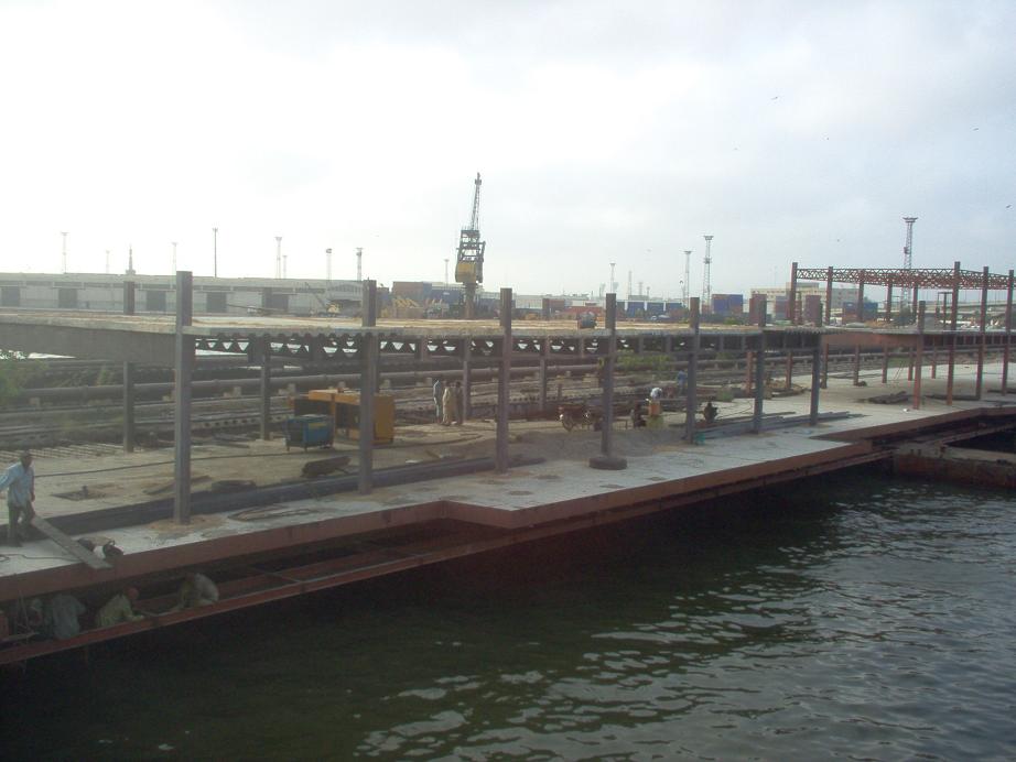
Today, most of the older tensions have faded. The Port of Karachi retains its position as an important industrial and financial center in Pakistan, and it handles most of the country's overseas trade.
The Port of Karachi is one of the world's fastest-growing cities, and it faces the challenges of rapid growth: traffic, pollution, street crime, and poverty. These problems plague the Port of Karachi with a reputation for being a not-very-livable city. Traffic and air pollution are major problems facing the city, and the city has created new parks and planted trees in hopes of reducing pollution and improving the environment.

Tuesday, January 4, 2011

climate of gawadar

Gwadar is at 0–300 meters above sea level, is dry arid hot. The oceanic influence keeps the temperature lower than that in the interior in summer and higher in winter. The mean temperature in the hottest month (June) remains between 31°C and 32°. The mean temperature in the coolest month (January) varies from 18°C to 19°C. The uniformity of temperature is a unique characteristic of the coastal region in Balochistan. Occasionally, winds moving down the Balochistan plateau bring brief cold spells, otherwise the winter is pleasant. In Gwadar, winter is shorter than summer. Although Gwadar is not a monsoon region it still receives light monsoon showers coming from Karachi. But in winter, Western Disturbance can cause heavy Showers. Annual rainfall is only 100mm (3 inches). In June 2010, Gwadar city was battered by Cyclone Phet with record-breaking rains of 372mm and winds up to 75 mph.

Monday, January 3, 2011

antroduction gwadar


Gwadar  is a developing port city in Balochistan, Pakistan, which is situated on the southwestern coast of Pakistan on the Arabian Sea with a population of approximately 50,000.
Gwadar is strategically located between three increasingly important regions: the oil-rich Middle East, heavily populated South Asia and the economically emerging and resource-laden region of Central Asia. Gwadar is the location of the Gwadar Port, a warm-water, deep sea port.
The Gwadar Port was built on a turnkey basis by China. It was inaugurated in the spring of 2007 by then Pakistani President General Pervez Musharraf. Gwadar Port is now being expanded into a deep sea port and naval base with Chinese technical and financial assistance. Gwadar Port became operational in 2008 with the first ship to dock bringing 52,000 tonnes of wheat from Canada. Pakistan's Minister of Ports and Shipping, Sardar Nabil Ahmed Khan Gabol, officially inaugurated the port on 21 December 2008.[2China has acknowledged that Gwadar’s strategic value is no less than that of the Karakoram Highway, which helped cement the China-Pakistan relationship. Beijing is also interested in turning it into an energy-transport hub by building an oil pipeline from Gwadar into China's Xinjiang region. The planned pipeline will carry crude oil sourced from Arab and African states. Such transport by pipeline will cut freight costs and also help insulate the Chinese imports from interdiction by hostile naval forces in case of any major war.
Commercially, it is hoped that the Gwadar Port would generate billions of dollars in revenues and create at least two million jobs.[3] In 2007, the government of Pakistan handed over port operations to PSA Singapore for 25 years, and gave it the status of a Tax Free Port for the following 40 years. The main investors in the project are the Pakistani Government and the People's Republic of China, making China's plan to be engaged in many places along oil and gas roads evident                        

Saturday, January 1, 2011


Karachi Sea Port is not only the largest Sea Port of Pakistan but also the busiest Sea Port of country. With its 30 berths and 2 wharfs it handles about 60 % cargo of the Pakistan. It is situated in the old Karachi city with industrial and business sectors of the city. Karachi Sea Port was first opened in 1864 during British Raj. Its management and administration is the responsiblity of Karachi Port Trust.

gwadar port look


Gawadar is the smallest seaport of Pakistan. It is the newly built seaport which is situated on the coastline of Balochistan province which is about 600 km long. Gwadar Port is a warm water seaport which became operational in 2008. It is the third major sea port of Pakistan after Karachi port and port Qasim. Gawadar port was set up in order to connect the land locked countries of Central Asia with the rest of the world through this sea route.

longest coastal area of pakistan


Longest Coastline Of Pakistan is Balochistan coastline which is 771 kms long while the total length of the coastal areas of Pakistan is about 1100 km. The coastal areas of Pakistan are in the province of Sindh and Balochistan. These coastal areas are on the shore of Arabian sea and it connects Pakistan with other countries of the world through a sea route. Gawadar and Karachi are two prominent ports on thesecoastal areas of Pakisan. The city of Gawadar is developing very sharply because of the seaport. Gwadar is a district along the sea in south of the Makran. The coastline of Gwadar District is about 600 Kilometers long. Gawadar port can become a trade hub for all the neighbouring land locked central Asian countries of Pakistan